Now Reading: Pakistan Launches Its First Hyperspectral Satellite
- 01
Pakistan Launches Its First Hyperspectral Satellite

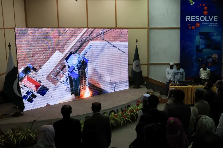
Pakistan has achieved a remarkable milestone in its journey toward scientific and technological advancement with the successful launch of its first hyperspectral satellite (H1). This historic launch marks a new era for the country’s space program, opening up vast opportunities in environmental monitoring, precision agriculture, urban planning, and disaster management.
The launch took place from China’s Jiuquan Satellite Launch Centre, reflecting Pakistan’s growing collaboration with China in the peaceful use of space technology. The Space and Upper Atmosphere Research Commission (SUPARCO) announced the successful deployment of the satellite, calling it a “major step forward” for Pakistan’s space ambitions.
What Is a Hyperspectral Satellite?
A hyperspectral satellite is a powerful Earth observation tool that captures detailed images of the planet using hundreds of spectral bands. Unlike traditional satellites that take regular color images, hyperspectral satellites can detect even the smallest chemical or material changes on the Earth’s surface.
This unique ability allows scientists to monitor soil health, vegetation growth, air quality, and water resources with high precision. It also plays a crucial role in identifying mineral deposits, pollution sources, and crop diseases before they become widespread problems.
Boosting Pakistan’s Environmental and Agricultural Capabilities
The Pakistan Hyperspectral Satellite (H1) is expected to bring significant improvements in various fields. According to SUPARCO, the satellite’s data will revolutionize agricultural productivity and environmental management.
Farmers and agricultural experts will be able to use the data to monitor crop quality, soil fertility, and irrigation needs more accurately. This will not only enhance food security but also help Pakistan adopt more sustainable farming practices.
Furthermore, environmental scientists will use the satellite’s imagery to monitor climate change impacts, detect forest degradation, and manage water resources effectively. In a country frequently affected by floods and droughts, this data will be invaluable for disaster preparedness and response.
Enhancing Urban Planning and Disaster Management
One of the most promising uses of the H1 hyperspectral satellite is in urban planning. As Pakistan’s cities continue to grow rapidly, the need for efficient planning has never been greater. With the high-resolution data from the satellite, authorities can map out land use, monitor air pollution, and manage infrastructure development with precision.
In the area of disaster management, the hyperspectral satellite can detect damage from earthquakes, floods, and landslides much faster than traditional monitoring systems. This will allow rescue teams and policymakers to make faster, data-driven decisions to minimize losses and protect communities.
Strengthening the China-Pakistan Partnership
The launch of the H1 satellite also reflects the deepening strategic and scientific cooperation between Pakistan and China. Both countries have worked together for years in the field of space exploration and technology sharing.
According to Pakistan’s Ministry of Foreign Affairs, the mission symbolizes the “ever-growing partnership” between the two nations in advancing peaceful space exploration and promoting socioeconomic development.
The China-Pakistan Economic Corridor (CPEC) is another area expected to benefit from the new satellite’s capabilities. The data collected from H1 will help identify geohazard risks and support better infrastructure planning along the CPEC routes, ensuring safer and more sustainable development.
SUPARCO’s Growing Space Program
The Pakistan Space and Upper Atmosphere Research Commission (SUPARCO) has been expanding its efforts in recent years to enhance the country’s presence in space. According to reports, Pakistan has launched three satellites in 2025, including EO-1 and KS-1, which are already fully operational in orbit.
The H1 hyperspectral satellite is expected to become fully functional within two months after system calibration. Once operational, it will play a major role in achieving Pakistan’s Vision 2047 goals related to technology-driven economic growth and environmental sustainability.
A Vision for the Future
The successful launch of the Pakistan Hyperspectral Satellite (H1) represents much more than a technological achievement it is a symbol of national progress and self-reliance. By investing in advanced space technologies, Pakistan is preparing itself for the future, where data and science will lead the way in solving complex challenges.
As SUPARCO Chairman Muhammad Yousuf Khan stated, “The data from the Hyperspectral Satellite is poised to revolutionize agricultural productivity, bolster climate resilience, and enable optimized management of the country’s vital natural resources.”
With this groundbreaking step, Pakistan has joined the ranks of nations using hyperspectral imaging for sustainable development. It marks a pivotal moment in the country’s history one that promises to shape a smarter, safer, and more resilient Pakistan for generations to come.